Travels with Annie and Elmo

Travel should be a journey where the destination is just another part of the Journey.

Monday, January 15, 2007

Lessons Learned


Lessons learned

January 8, 2007

Elmo is still trying to learn a few things; at least I think he is trying. Occasionally he stays next to us on the trail instead of charging the person coming the other direction. I have explained that most of those people are not aware that his tail is wagging, and that all he wants is a rub and reassurance that he is the most lovable dog in the world. I have even explained that some of them may actually be afraid of him, a concept that he still fails to grasp.

When he does stay, he also looks up and smiles at Annie and me, like he is really proud of what he has done.

Annie and I are also learning and wandering helps us learn. Like Elmo, we look up and smile because we are proud of learning these lessons. However, realization of lessons learned comes to us slowly like a form out of the fog finally recognized. We are confident that there will be others, but here are the ones that have already emerged.

1. It is OK to turn around. Focus on the destination causes us to miss things that should not be missed. We might be flying down the highway concentrating on the Rush Limbaugh show (just kidding) and miss the turn to Athabasca Falls, which we wanted to see; but we were planning on being in Jasper tonight. At one time in life we shrugged and rushed on toward the destination. Now we turn back. We may not have another chance. There is really only one destination and some day we will arrive. In the mean time we are just wandering.

2. Take the next right. The unplanned adventure may be the best. On a whim we turned off the Trans Canada Highway and found a village dropped out of a Ukrainian space ship that boasted the biggest Easter egg in the world. The Maine Coast was filled with narrow winding roads that ended at the Atlantic. It was impossible to follow them all or to decide which would be best. So we would just take the next right and follow it until something else called.

Even better would be to get lost and not worry about it.

3. Avoid Cities. As we became more comfortable in the wilderness, we became less comfortable in cities. Villages were OK, even small towns, but cities made us uncomfortable. We usually picked the city for motel night. Sometimes we would hide in our motel room until we could get up and wander on down the road. Entering the city was like an overdose of caffeine or the onset of the flu. We knew something was wrong but were not sure why. Now we know, it is the city; too many streets, too many cars, too many people in a hurry, too much dirt and garbage and fear and stress. In the city we were lost; not the external kind of lost that sharpens one’s senses and thrills with adventure, but the discouraged lost that takes permanent residence in the heart.

4. Call of the wild. Wild places sing a siren’s song that we both hear. That song, for many years, has been unrecognized background music in our lives. Now it is surround sound, like the base emanating from the low-rider hunching down the loop two miles away and rattling the pictures on the wall. And we have no mast or rope.

5. Wander slowly. A baby moose, crossing the highway behind his mother, clops along on his stilts. Red lichen grows on a granite rock next to an icy blue lake. A river foaming and crashing over boulders races down the mountain. A pretty girl at a rest stop points to the eagle hunkering on a naked limb at the top of the dead spruce next to the picnic table. We see none of these from 40,000 feet inside the skin of a Bowing 747.

We don’t hear the Eagle’s screech or smell the flavor of the forest floor or feel the icy sting of the glacier river at seventy miles an hour from inside the Highlander.

The little birds don’t gather overhead when one is struggling up a wilderness trail, and the red fox next to the water who watches us maneuver the raft through the difficult rapids remains unseen.

Probably the best way to wander is to sit; at least most of the time.

6. The back of a Highlander will hold all one needs to live well. “Remember when we could get everything we owned in the back seat of the car?” That is a quote from everyone. We have all said it, usually with nostalgia and longing shortly after digging through several piles of crud that was not needed when bought, hasn’t been used in the last twenty years, and would most likely be rejected by Goodwill. Life piles up around us like climber’s discards on Mount Everest where moth and rust do not consume. Most of us still find it impossible to take something off the mountain. We in fact keep adding to the piles, thereby forcing our children to take off two weeks when we die instead of one just to throw it all away.

We were reminded that we really don’t need much stuff to have a very good life. We lived six months, six great months, on what we could squeeze into the Highlander. OK, OK we did have the car top carrier filled as well. The only thing we both missed was the salad spinner. I hope that we will remember the joyful simplicity of less.

7. There were good reasons for Anne and Tim to marry. I realize that this lesson could have gone the other way. We might have learned that there were no reasons. Fortunately that was not the case. In the last six months, we have spent more time together than we did in the first forty-one years of marriage.

We did have one brown out. At Liard Hot Springs rain started about the time we needed to cook. If it had been two degrees colder it would have been snow. I was in a good mood. I built a big fire, got out the umbrellas, set chairs by the fire, and tried to coax Annie out of the tent by convincing her how great the experience was. Most of you can imagine the result of my enthusiasm. We survived that and there were no others; probably the least conflict in any six month period of our marriage.

We were also reminded that we like each other. We have fun together. We like doing the same things. We love nature and the beauty of God’s creation. We long for our grandchildren and great grandchildren to have the opportunity to experience that beauty. Wild majesty is spiritual to both of us.

I found a poem yesterday that I had written to Annie on one of her birthdays. It says why I like wandering with Annie. She said I could share it.

Chips and Salsa

By Tim Banks

2/24/2002

You are how I feel

When I remember the smell

Of bread baking

Or see a basket of chips

And a big bowl of salsa

Waiting on the table.

Knowing you is like being surprised

By the perfect sunrise,

There when you turn back,

Draped and glowing sunrise colors

Across the bottom of dark gray clouds

Loving you is being caught

When about to fall or

Snuggling warm and cozy

Under piles of cover

When the cold wind blows

Rain drops against the window pane.

You loving me is life

Like air and water

Our souls wrapped in one another

Forever.

Thursday, December 28, 2006

Top Ten Drives

Elmo’s Top Ten Drives

December 5, 2006

Between May 15 and November 8, 2006 we drove 20,000 miles around the North American continent. We crossed prairies, climbed mountains, dipped into canyons, stopped by lakes and streams, camped in twenty state, provincial and national parks, watched the sun sink into the Gulf of Alaska and watched it emerge from the Bay of Fundy. We followed early spring from Texas to Alaska, and followed early fall across Canada to Maine. When we got back to Texas in November we had three days of summer.

The entire drive was a delectable gourmet meal, but some courses were better than others. A few were so special they make my mouth water when I think of them. Coming up with the top ten drives was not so difficult; putting them in order was. Each one of the drives described here is worth the effort to get there.

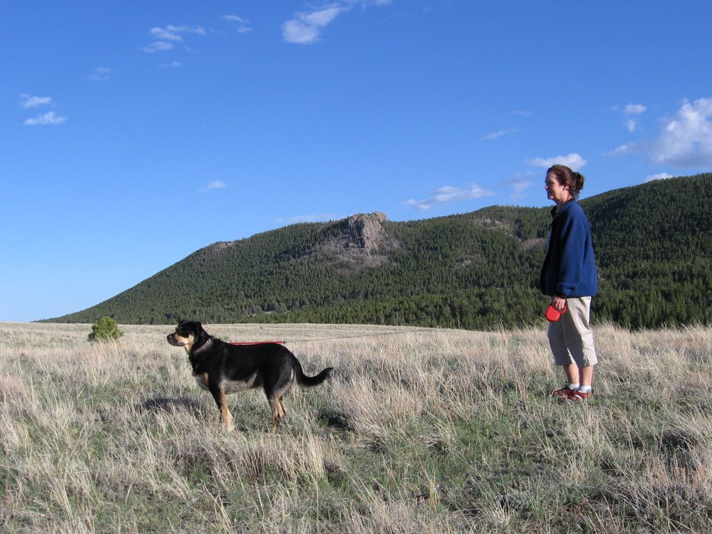
We admit to some possible bias. It may be that that which is most different from our every day experience impresses us the most. For example, how could we leave the drive through Yellowstone out of the top ten? I don’t know; maybe people, or signs, or board walks, or the fact that it is on all the top ten lists. We had to vote, and all three of us picked Flathead Lake and the White Mountains over Yellowstone

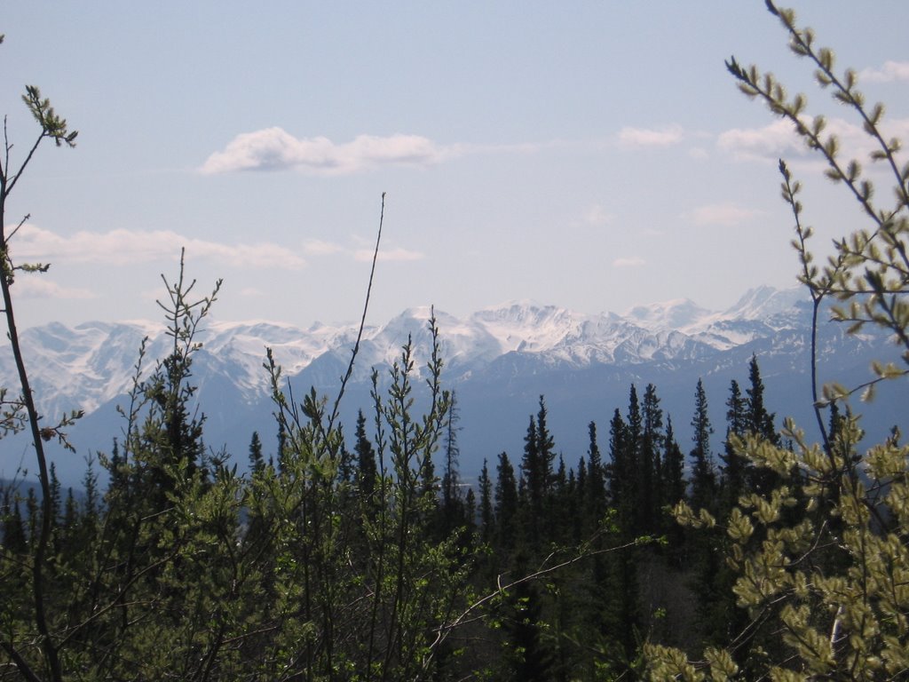
The top two drives are in Alaska. Part of two others is also in Alaska. But Alaska is special and there are not many highways in Alaska. You can drive Highway 1 from Homer at the end of the Kenai Peninsula through Anchorage to the Tok cutoff on the Alaskan Highway. In Alaska the Alaska Highway is Highway 2 and runs from the Canadian border to Fairbanks. Highway 3, the Parks highway runs from Anchorage, past Denali to Fairbanks. Highway 4 connects Delta Junction on the Alaska Highway to Valdez on Prince William Sound, and Highway 11 runs along next to the Alaska pipeline from just outside Fairbanks to Prudhoe Bay. Highway 11 used to be paved mostly with frozen tundra. A large portion of it is now paved with melting tundra.

We have driven at least a portion of all these highways except the melting tundra highway. We even drove Highway 8 from Paxson to Cantwell. The first 11 miles is paved and the next 111 is washboard occasionally replaced by muddy ruts. Highway 11 is called the Denali Highway and at one time was the only way to get to Denali National Park.

Five of our top ten are either all in Canada or partially in Canada. Only two are in the lower forty-eight.

Remember that this is not a top ten for all of North America, only for the track we wandered. And you are only going to get a taste of each one, like the tiny glasses of beer they line up when you go to a brew pub. You will not get drunk. But you might order a pint of one or two.

Enough of the disclaimers. Here they are in reverse order, with a little help from Annie and Tim; Elmo’s top ten drives:


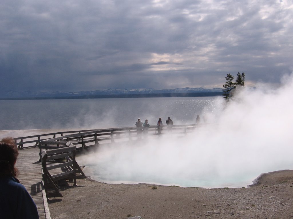
10. Drive Through Yellowstone. This drive is on everyone’s top ten list, and there is a reason. This place is special. We should have spent more time there.


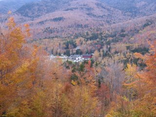
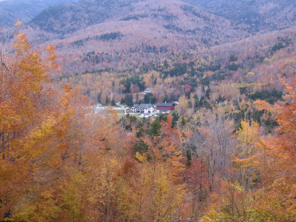
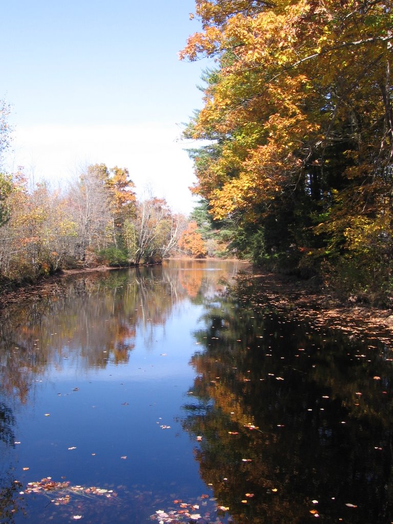
9. Wandering Highway 2 through the White Mountains of New Hampshire and Maine. We liked this narrow track so much that we drove most of it twice, once coming from Alaska to Maine and once on our tree peeping tour. Here is my description from our first drive down Highway 2:

A few minutes later we turned east on highway 2, a two lane highway that in most places Elmo could jump without a running start and which went north, west, south, up, down, and around almost as much as it went east. Villages resembling pictures of New England hamlets with names like Concord, Lancaster, Mt. Madison, Gohrman and Giliead were scattered along Highway 2 close enough to each other for the mayors to waive.

Each village had several white clapboard churches with Paul Revere steeples, stacked stone walls, salt box houses, flashes of color on the maples, roadside stands selling hand crafted maple syrup, gift shops, gardens overflowing with blooming flowers, a speed limit of twenty miles an hour and more cars from Boston than New Hampshire or Maine.

On top of that description add cool sweet air and layers of fall colors in multiple shades and values; yellow, red, orange, green, lime green, purple, rust and brown swished and swirled and dribbled across the hills and exploded in front of the white houses lining village streets.


8. Alaska Highway from Liard Hot Springs to Fort Nelson. We drove this road both directions, which I highly recommend. This drive could be number seven and eight. For example, Summit Lake is really two lakes. When you drive north it is a shock appearing as you top summit pass, naked in its bed hugged by rocky peaks. When you are going south, it is a cool drink on a hot day sipped slowly, or like Sophia Loren tossing her beach towel between my towel and the water when no one would miss me even if I stayed all day.

In either direction you drive through the Barricade Range and the Sentinel Range; you drive over Muncho Pass and Summit Lake pass, and through four Provincial Parks (the Province is British Columbia), not counting Liard Hot Springs. The road curves along with the Liard River in the North and tumbles with Tetsa River in the South and East. We stopped for stone sheep grazing in the rocks next to the road and to let reindeer and moose cross the road.


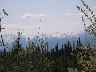
7. Alaska Highway from Haines Junction (Yukon Territory) to Tok Alaska. The view from one spot on this drive is the wall paper for my computer. Here is the essence, what I said when we were driving this road. I cannot give you a better taste.

Mountains in front of me, mountains to the right of me, mountains to the left, and mountains behind me; mountains behind mountains behind mountains; layers of mountains upon layers of mountains, and those most far, white towers where the sun streaks through the cloud, hurting my eyes. The sense of distance and mass is like other worlds, like planets or moons suddenly on the horizon, in our atmosphere.

There is so much beauty. I am not numb to it, but I am incapable of taking it all into my soul and storing that certain view of a lifetime when a turn of the head, a blink, a curve in the road presents me with another.

When we were looking at this, Annie said, “Can you imagine what David and Joey thought when they first saw this, knowing that this beauty would be their home?”


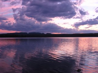
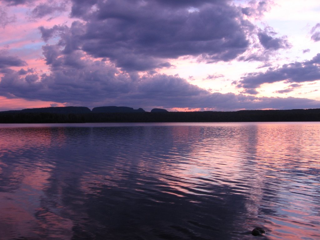
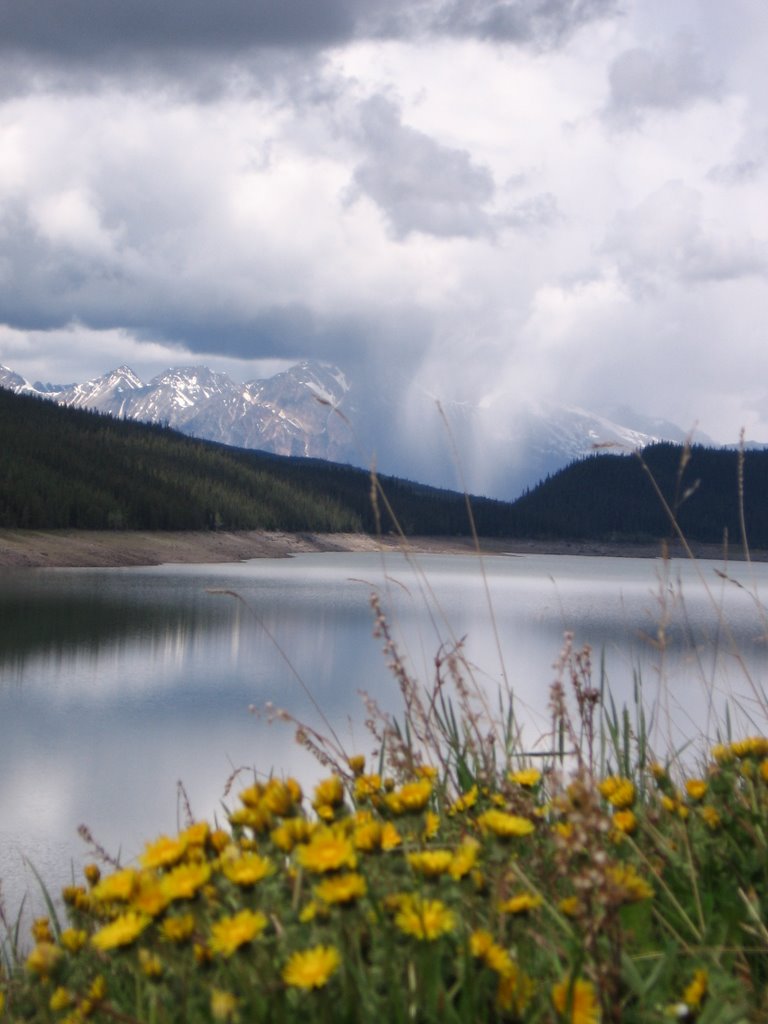
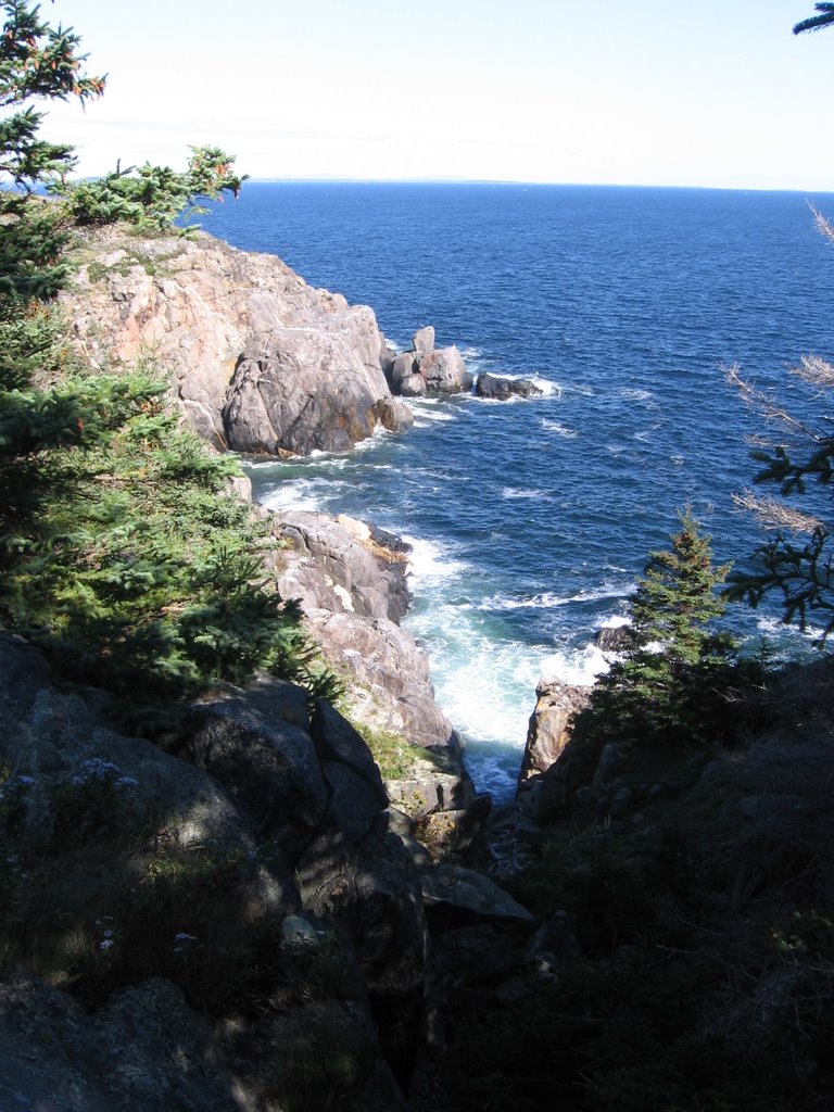
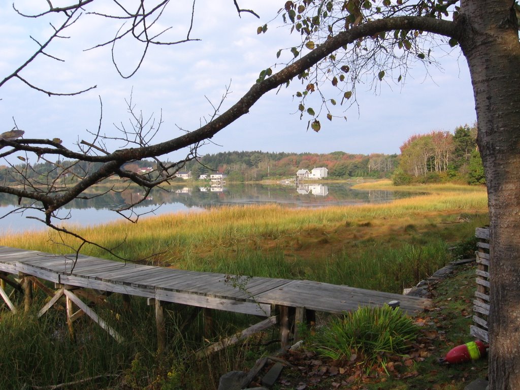
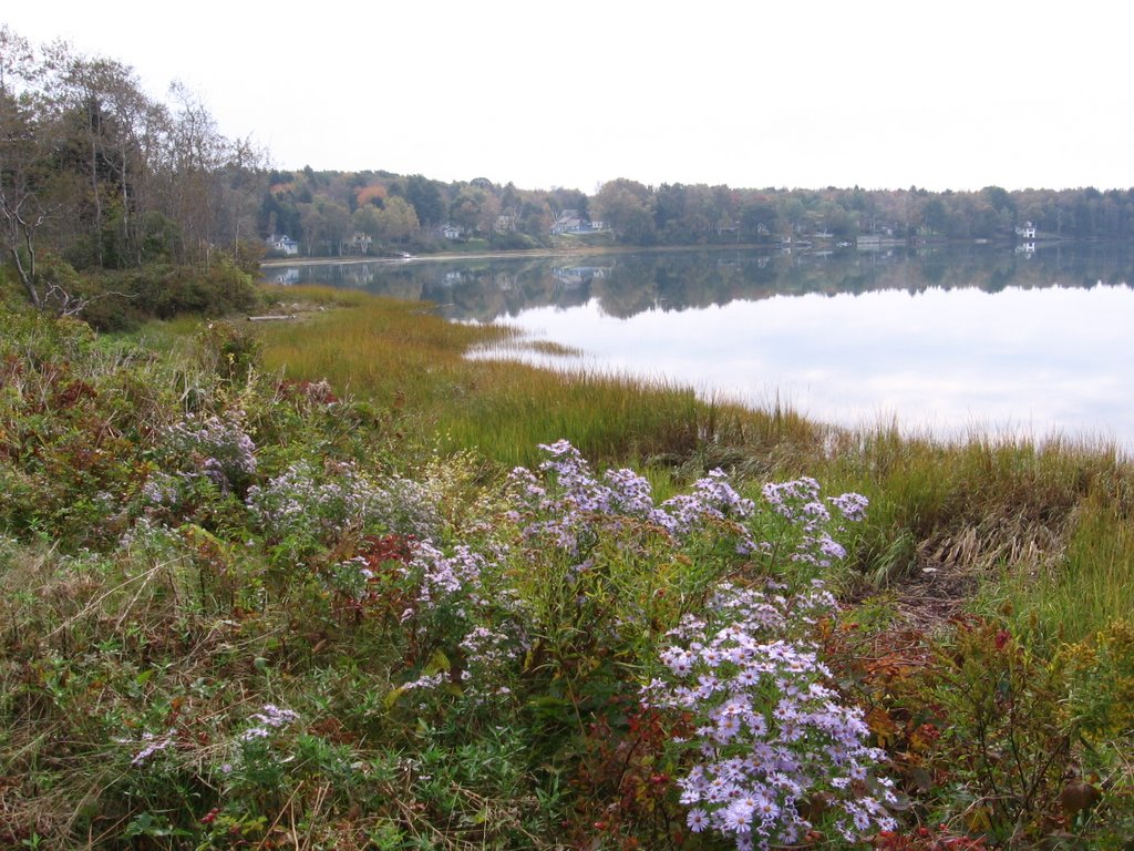
6. Drive along the northern shore of Lake Superior from Sleeping Giant to Marathon and the eastern shore from Wawa to Batchwanna Bay; Canadian Highway 17, Ontario. I left out the piece of highway that runs inland for about fifty miles. It is also beautiful, but does not compliment this visual feast. This drive was like finding an ocean in the middle of the continent. We drove for parts of three days along the shore of Lake Superior, all that in Canada. The shoreline in the US is longer than that in Canada. We camped next to the water at Sleeping Giant and Agawa Bay. This is the drive of sunsets, sunsets behind rolling mountains, sunsets slipping silently into sun colored water; this is the drive of islands, granite cliffs, small deep blue lakes sleeping in granite holes next to the great lake; the drive of roads curving around hills and dipping into valleys, bays and sandy beaches, boat filled harbors; and the drive of horizons laid with a gentle curve over the water. Famous artists come here to paint.


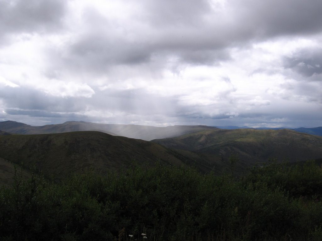
5. Top of the World Highway. This “highway” runs from the Canadian border to Dawson in the Yukon Territory. It is approximately 150 miles south of the Artic Circle. Part of the fun of this drive is that you have to go through Chicken, Alaska (named by prospectors who couldn’t spell ptarmigan) to get to the Top of the World Highway. We had driven through wilderness for much of our entire adventure. But the drive up to the Top of the World Highway and then along that highway presented a new definition of wilderness. Other than the road under our tires, Chicken, the border outpost, and a mining barge crumbling in the bottom of a canyon where more water must have one day flowed; there was no hint of human habitation; no building, no fence, no telephone or electric line, no roadside park, no plowed field, and no sign advertising that which we could not live without. The Top of the World Highway curves gracefully from ridgeline to ridgeline through high tundra. I think we could see mountains on the Artic Circle to the north. We saw the highway ten miles ahead topping a ridge, disappearing, and then reappearing as a smoky line on another ridge far to the East where the sun squeezed through dark clouds and flashed on the windshield of car we never saw. At one end of this road is the border station perched at the top of bare hill, alone, waiting for a passport to peruse, a citizen to quiz; at the other end is the free ferry that takes cars and people across the Yukon River to Dawson.


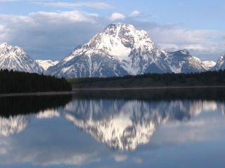
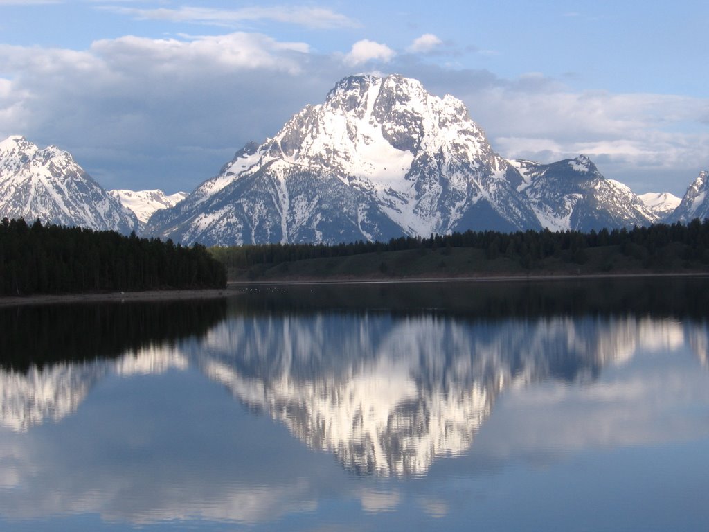
4. Drive into Grand Teton National Park, Wyoming. There had to be some of Highway 287 on this list. This drive should start on the great prairie just before 287 tumbles into the Wind River Valley near Dubois. Here is a piece of my original essay:

At one point 287 led us across a prairie that was like a yellow table cloth stretched from horizon to horizon. It seemed to have no end. And at that moment we fell off the table cloth and into the side canyons zigzagging and tumbling into the incomparable Wind River valley filled with green fields and surrounded with rocks like castles and turrets and minarets and steeples painted in alternating layers with ice cream colors, strawberry, vanilla, strawberry, vanilla, strawberry.

At the end of The Wind River valley 287 went up the mountains through the snowy pass and showed us the Teton Mountains, hazy white peaks thrust jaggedly into the heavens.

We drove, mesmerized, toward those most mountain-like of mountains until in the park where we stopped at water’s edge on a day when the air did not move and there found an inverted Mt. Moran napping on the polished surface of Jackson Lake.


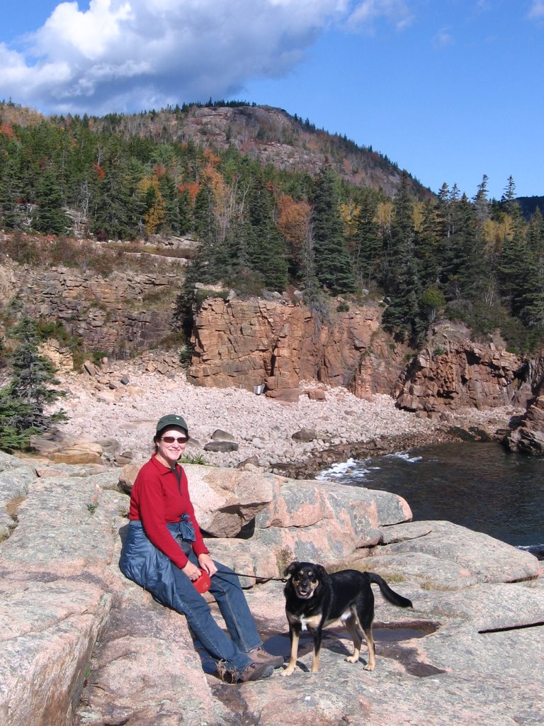
3. Banff National Park to Jasper National Park, Alberta. This drive has to be about Banff National Park and Jasper National Park because the entire drive is in one park or the other. It is the singing ice, orange lichen, and bike trail along the bow river at Lake Louise; it is the village of Jasper, Athabaska Falls, and hiking the narrow trail through the smooth tunnels and slots carved in stone by the Maligne River. It is also the high road passing gray granite mountains shimmering in early sun, passing the icefields, remnants of the last advance of the glaciers, passing black bears, buffalo, elk, big horn sheep, and finding fairy slippers next to the tent. It is smelling the earth after the rain and hearing water crash into rocks and tasting the local beer in Jasper.


2. Palmer to Matanuska Glacier, Alaska Highway 1. It was a dark and rainy evening, and a black BMW motorcycle accelerated out of Palmer whining through wisps of fog slithering over the road like fat snakes. A form clad in leather the color of fresh blood and wearing a moon walker’s helmet squeezed the BMW with her thighs and snuggled to the gas tank. The form seemed to be painted onto the motorcycle. They leaned into the sharp curves, left toward the cliff that melted and dribbled fiery gold fingers onto the road; then right toward the boiling river, the Matanuska, like curdled milk whipped with chocolate, tumbling over walking rocks and spinning milky fairies into the dripping air. They miss, but barely, the mechanical elephants hauling silver rockets toward Palmer. Rock castles flash on and off in the distant silhouetted against a rolling black sky. Behind the BMW Harry Potter and some of his friends follow on broomsticks slinging lightning bolts at the Four Horsemen of the Apocalypse. The BMW zips down a steep hill, compresses onto a high bridge, dodges ogres, and flashes up the other side of the canyon. At the top of the canyon the Matanuska Glacier appears, rises slowly out of its ancient bed and grows, swelling into the hevans and across the earth like a living organism. The BMW screams to a stop at the Scenic Overlook. An old man, a woman and a dog who had been watching the glacier glance at the motorcycle.


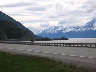
1. The Seward Highway from Anchorage to Seward, Alaska; Highway 1 and Highway 9.

We have driven this Highway more than any other in Alaska, and still it is our favorite—kind of like being married to Annie.

The Seward highway follows Highway 1 out of Anchorage to Tern Lake Junction where Highway 9 begins. Highway 9 ends at Seward, a village hanging to the edge of the mountains at the top end of Resurrection Bay. Across the bay are stark mountain peaks cut by blue green glaciers. On a clear day you can see the outline of Fox Island where Rockwell Kent hid from life with his son, painting, writing, and healing. On Top of the mountains above the village is the Harding Ice field which covers the Kenai Mountains from Seward almost all the way to Halibut Cove and is the mother to over thirty active glaciers; one of which, Exit Glacier, can be reached by car just off the Seward highway.

Boat people land in their thirty story ships in Seward and take the train or bus to Anchorage. If they fly home from Anchorage and don’t come back to Seward, they miss the best part of our number one drive. The Seward Highway is most spectacular on the drive from Anchorage to Seward. Going the other way, it would probably be only Number four.

Just as you leave Anchorage the Seward Highway tops a ridge above Potter Marsh, a great place to stop and watch sea birds. At that point you can see the first fifty miles of the Seward Highway. This section snakes along the shoreline of Turnagain Arm, a piece of ocean flowing off Cook Inlet, which is a piece of ocean flowing off the Gulf of Alaska, which is a piece of ocean responsible for feeding most species of the Pacific including humans. Turnagain Arm is shallow; Tide sweeps in and out boiling along the rocky coast and over the muddy flats like a mountain river rushing to the sea. Across the arm is the northern end of the Kenai Peninsula lined with black snow capped mountains piercing low hanging clouds or, if you are very lucky, jutting into a brilliant blue sky. Above the highway on the north side of Turnagain Arm is the Chugach Mountains laced with waterfalls, and at the far west end of the arm are the mountains giving birth to Portage Glacier which scrubbed out the rut into and out of which Turnagain Arm rushes.

From Potter Marsh; past Indian, Bird, the turn off to Girdwood and the Alyeska Ski Area (also the route to the Crow Pass Trail, which many of you know as the Girl Scout Trail); to the turn off for Portage Glacier and Whittier, Turnagain Arm and the surrounding mountains continue to thrill. For the remainder of the Seward Highway, one must be content with great mountains, high passes, lakes, thick forests, rushing streams, milky glacial rivers, canyons, trail heads leading to fabulous hikes, glaciers, and Moose Pass (the village).

There they are, Elmo’s Top 10 drives for this trip. Some of these would make a lifetime top 10 list. Where one wanders, wander slowly.

Thursday, October 26, 2006

Acadia and Down East


Acadia and Down East

October 24, 2006

Last week we drove Highway 1 up the coast of Maine heading for Acadia National Park and “Down East.” The trees may have been more beautiful than the trees on our tree peeping tour to the White Mountains. Even the red oaks and pin oaks were deep red and copper. The Maples that were first to turn had dropped leaves starting from the top down (where the wind blows harder, I guess). Some Maples, fiery red, were still scattered on the hillsides, and the aspen, more profuse the further north we went, painted great swaths of yellow across the hills.

We camped three nights at Black Woods Campground in Acadia National Park on Mount Desert Island. They had already closed the other campgrounds, and only a little piece of Black Woods was open. The ranger taking our money at the entrance told us that even Black Woods would close November 1. Not only do the camp grounds close many businesses and restaurants were “closed for the season.”

Despite the closures, early October would be the perfect time to visit Acadia. Annie sat at the picnic table early in the morning wearing three layers of jackets and gloves waiting for the coffee to perk. The sun came through the spruce and warmed her face. There was no wind. The air was crisp. It felt like fall should feel. The crowds; up to nine thousand visitors check in each day at the visitor’s center in the summer; were gone.

Acadia is Lakes (ponds in Maine), rocky coastline, mountains, the view of painted forests the ocean and strings of islands from Cadillac Mountain, a year’s worth of trails to wander, and the “carriage roads.” Between 1913 and 1940 John D. Rockefeller, Jr. designed and built carriage roads all over the park so that it could be enjoyed with out “disturbance from the automobile.” This may be my new favorite old man’s place to bike. There are forty miles of packed crushed stone roads meandering over hills, through valleys and around lakes. I road a wonderful loop around Jordan Pond, by the end of Eagle Lake and past Bubble Lake.

Incidentally, we discovered another good thing about getting older; I bought a life time pass to US National Parks for $10.00. From now on we get into parks free and also get one half off camping fees.

Down East is what they call the most easterly part of Maine. It is also called the Sunrise Coast because the sun lights it’s rocks before anywhere else in the lower forty-eight. The most easterly point in the lower forty-eight is West Quoddy Head outside Lubec, the most easterly village. We walked a trail along the coast and Elmo climbed the rocks down to the water where the only part of the continental US to the east is in the Aleutians.

Wandering Maine


Wandering Maine

October 21, 2006

When I woke up this morning I had decided that Journey Travel should be called “Wandering.” That is the noun. The verb is, “wander.” When we were in Alaska, Joey went to Sitka and brought me back a t-shirt that says, “The Journey is the Destination.” My motto for this blog was, “The destination is just another part of the journey.”

This morning I think that both the Sitka t-shirt and my motto may miss the idea of Journey Travel. They both emphasize the destination. Maybe there is no destination, only the journey, and the journey is but wandering. I have another t-shirt that says, “Not all those who wander are lost.” So maybe even if we wander, we are not lost. That would be good news.

We wandered northwest to look at leaves. We started on back roads, the ones that have names, not numbers. Orange leaves on red maples shimmered along Swamp Road, flashed on the round hills above Quaker Meeting Road, and huddled in the gullies Poland Range Road crossed on narrow bridges. Depot Road led us to Gray (the village) which was not gray; but vermilion, crimson, yellow ochre, and lemon.

We turned north at Gray on a road with a number and watched the reflection of red leaves on sugar maples in Crystal Lake, Upper Range Pond, Tripp Pond, and Pennesseewasse Lake. At Bethel our old friend Highway 2 meandered west so that we could watch yellow leaves on aspen reflect in the ripples of the Androscoggin River. The leaves led us into New Hampshire where we stopped for lunch at Saladinos in Gorham and then drove to the top of Mt. Washington (worst weather in the US) to shiver in the cold wind and look at leaves as far as the eye could see. Annie and Elmo took me up a trail near the edge of White Mountains National Forest that was littered with dappled orange, yellow and red leaves.

Just before the light faded Parnelli Annie rocketed the Highlander back to Maine over Hurricane Mountain Road, and we wandered the back roads to Bathtub Cove knowing that were passing colored leaves in the dark.

The Artist Eye


The Artist Eye

October 20, 2006

It is raining and I can just make out the pale gray line of trees dipping close to the pale gray water at the far end of the cove. The green has abandoned the oaks leaving copper polished like the big tubs for sale along the road in Mexico, rust like the splotches on an unused crosscut hanging on the side of a forgotten Maine barn, and red like looking at the sun through a glass of cabernet. The maples that turned first, the burning red ones, have dropped most of their leaves. Stragglers remain, a torn red leaf hanging alone at the end of a branch. Some maples the ones that look like the leaves were painted with sun and dipped in blood are full color. I think the color is more spectacular now than when the sugar maples emerged dripping red from surrounding shades of green.

I asked Len, the lady who owns the Eastland Motel (emphasis on “Mo”) in Lubec, if she knew of any spots around Lubec that would be good for painting. She told me a long story about her friend, Sally, who paints, the essence of which is that Sally sees things differently. Sally notices things that Len would never see, and sees possibilities for a painting where Len sees nothing but an old barn and a sick looking cow in a muddy lot. Sally sees with the artist eye. She sees texture, contrast, shadows, structure, eye candy. She has the artist eye.

I started painting with watercolors after we came to Maine. Maine begs one to paint. Ask Andrew Wythe. I don’t have the artist eye yet, but it is growing slowly in my brain. I already notice special scenes, I never saw before. We drive down untourist roads looking for places that need to be painted. I get out of the car where an old wooden shrimp boat with pealing green and white paint and broken windows is propped in the mud next to a partially collapsed dock from which a gray shack hangs precariously. I run around snapping pictures. I look for angles, shadows, (where is the sun?) where the paint flecks glow, color, the blue plastic barrel in the foreground leaning against the stack lobster traps, orange and green lobster buoys piled and fading next to a heap of aged loading pallets, the red boat floating in the distance and the just painted white house set in the orange and red maples across the bay. Then I wonder about the boat’s history, the owners, the families it supported and where they are now, the storms and close calls, the decision to park it in the mud and whether anyone remembers that it is here; or cares.

Whether one paints or not, developing the artist eye makes wandering special.

One place Len suggested that we go was the East Quoddy Head light house at the far end of the road on Campobello Island. Campobello Island is in New Brunswick, just across the bridge from Lubec, and is where the Roosevelts (Franklin Delano) had a summer house. I don’t know how to paint wind or sideways rain or the sound of waves crashing against the rocks or the white gull floating magically in the wind just above the mountain ash’s red berries. But I noticed them.

A picture of what I did paint is attached.

Thursday, October 12, 2006

Walking Monhegan


October 11, 2006

Walking Monhegan

I was surprised as much by the fact that no one had carved their initials in it as I was by the size. It was growing in woods so thick that nothing green grew in the soil, not even ferns or moss. It was like walking through a cave, spruce needles above, layer on layer until light was only a suggestion, a hint, and idea you might have had. The cave walls were skinny spruce trunks so close together a mouse could have peeked through at Elmo, unafraid of the consequences.

Oh, “it” was a mushroom, the size of a large dinner plate. I am including a picture. I had Annie put her hand next to the mushroom so that you would believe me.

Walking the trails on Monhegan is like going to a twelve screen drive in movie each screen showing a great mystery movie. One must choose a plot or two, and hope for the opportunity to return. Monhegan is an island about twelve miles off the Maine coast. It is only 1.7 miles long and .7 miles wide, but has over seventeen miles of trail. The village, where eighty to ninety people live year round and where the artists and tourists exponentially expand the population in summer, occupies a small part of the island. The rest of the island is owned or controlled by Monhegan Associates, Inc, a private land trust dedicated to preserving Mohegan’s natural state. So far it has done well. Very strict rules govern use of the land trust property. For the most part they are followed. I saw no trash or mindless destruction of nature on Monhegan.

We walked all the way around the island and hiked many of the cross trails. Each trail was a new movie; crashing surf, towering cliffs, ship wrecks, views of rocky gull covered islands, pebble beaches with basketball sized pebbles, musky trails through black woods, open spruce forest crisscrossed with tannin colored streams, forest floors carpeted with spongy moss and decorated with ferns yellowing, tiny fairy houses built under logs and between tree roots, views of the red roofed light house tender’s house, climbs up steep mini-mountains, bluffs covered in blooming asters, white/yellow grass topped with airy fluorescents, ocean side rock gardens decorated with creeping juniper and knee high ancient spruce distorted by Atlantic wind, granite rocks and ledges cracked by time and covered in green moss and orange lichen, shady groves of skinny paper birch and small smooth barked trees with yellowing leaves that look like a mulberry (probably a type of smooth barked maple), crimson leaves floating on pools of water reflecting pieces of sky breaking through forest canopy, red berries topping mountain ash and rained over some bush unknown to me, raspberry brambles fluttered with yellow rumped warblers, and the gatherings of common eider with its bright white back riding over the swells rushing toward the rocks below the island cliffs.

On top of a cliff on the east side of the island, I pointed to the horizon. “Look Annie,” I said. “What’s that? Is that Iceland? No. Not big enough. It must be Ireland.” I jumped up and down. “Annie, it’s a whale.”

Annie stared at the ocean for a few minutes. “Try super tanker,” she said.

The Raine Principle


October 5, 2006

The Raine Principle

The Raine Principle is part of Journey Travel. In the late 80’s we took a bunch of kids to England. We met a bobby (policeman) in London named David Raine. Raine had lived in London all his life. He knew the story behind every old pub in London and all the back streets between them. He loved London and loved to talk about his London. Wherever one wanders, there is a David Raine and the wandering experience will be much richer if the wanderer can find him.

Just before I left for Denton, Hal Morgan knocked on the back door. He wanted to know how to get in touch with the lady who owns our house. Hal is eighty-three years old and has lived in a little house with his wife near the end of Basin Point Road for the last fifty-seven years. Mrs. Morgan doesn’t get around too well any more; botched hip replacement surgery. Hal doesn’t have any front teeth, or at least he wasn’t wearing them when he knocked on the door. He was wearing patched overalls and a faded blue shirt. Hal is a lobsterman. He used to have a forty-seven foot boat and ran over a hundred and fifty traps. Now he has a twenty foot boat and runs twenty traps when the weather is good.

The tide was out and mud was shimmering in the cove about half way down to Hal’s house. I asked if anyone ever went clamming in Basin Cove.

“Oh yeah, this is the best clamming area in Harpswell. Even the commercial clammers use this cove. They will be right out there in front of your house.”

He was right. By the time we got back from Denton, the clammers were coming every day. They come when the tide is going out and stay until the water gets too deep for them to bend over and dig with their short handled clamming rake. To be a good clammer you must be able to cut your toe nails while standing and be able to hold that position while digging mud for at least six hours. They pull rafts that look like toy coal barges. They drag it across the soft mud and it floats behind them on water. They wear hip boots, say the F word more frequently than the grunts did in Viet Nam, and leave with bushels of clams in net bags thrown in the back of pickup trucks.

Before I met Bill (another David Raine), who lives in Cundy’s Harbor and who is the brother of Cathy who lives in Denton (small world), I thought that Harpswell was a peninsula. I was wrong. Harpswell is a town which consists of a neck and a mess of islands. We live on the neck, Harpswell Neck, which incidentally looks a lot like a skinny peninsula. Bathtub Cove is close to the ocean end of Harpswell Neck. The biggest islands are Great Island, Bailey Island and Orr’s Island. Cundy’s Harbor is on Great Island. The neck and all the big islands are hooked together by bridges. There are hundreds of other smaller islands in Harpswell. They have names and most have cottages, but you have to have a boat to get there.

Bill has lived in Harpswell since he retired from the Marine Corps twelve years ago. He told me that Harpswell has more shoreline than any city or town in the US. I believe him. We have driven down about a tenth of the side roads on both the Neck and the roaded islands. Each side road runs down a sub-peninsula off of which drive ways run down sub-sub-peninsulas. Every road ends at a bay or a cove or a salt marsh.

Bill also suggested that I not go clamming in front of the cabin without getting a permit from the city office on Mountain Road Which connects Harpswell Neck and Great Island. “I’m not even sure you can get a permit,” he said. “You have to live in the city where you are going to clam. Temporary residence may not count.” Bill laughed. “The commercial boys might not like you out there getting their clams.”

He told me about the Harpswell-Brunswick clammers border war. One time some clammers from Brunswick were clamming in a Harpswell bay. The Harpswell boys tried to run them off and the sheriff had to break up the fight. There was apparently some dispute about the location of the bay in relation to the border between Brunswick and Harpswell. The Harpswell city council called a special meeting to discuss the issue and both the Harpswell clammers and the Brunswick Clammers showed up. Before the end of the meeting there was a full scale riot. The sheriff and his deputies couldn’t break it up so they called in reinforcements from all over the area.

“The city game warden checks those bays all the time,” bill said. “He might get you before the clammers.”

One of the clammers in our cove is a woman. I was thinking about seeing if Annie wanted to do some clamming.

Wednesday, October 04, 2006

Salt Marsh

Our Cabin from across the bay


Salt Marsh

September 15, 2006

Annie is in Texas. Her father (Papa) is ill and tired, tired of living in a body that has worn out.

In the last four months, Annie and I have spent more time alone together (I know; I am leaving out Elmo) than any other time in our forty plus years of marriage. I have always loved her, but I like her now more than I ever have. I miss her already. Elmo misses her also, but then he misses her when she goes into the bathroom and closes the door. He and I are doing our best to take care of each other.

I will write about Papa, but I am not yet ready to do so.

In front of me, just out the window, across the deck and at the foot of the wall of stacked rocks is a salt marsh. I don’t know much about a salt marsh. We don’t have a lot of salt marshes around Denton or in the Colorado mountains where I have done most of my wandering. I heard a salt marsh expert on NPR say that salt marshes were critical to the entire ocean ecosystem and the air that we breathe; something to do with microorganisms. He also said that many of our salt marshes were dying and that they really didn’t yet know why.

Our salt marsh looks healthy. It may be best that I know so little. If I knew a lot, I would put the names on the paper and move on. But since I have no names I must watch it, feel it, smell it, hear it and get to know it so that I can write you a picture. Whether it is a bird, a flower, a tree or a person; we so often stop with the name. There is more to everything than the name.

The Bathtub Cove salt marsh spends part of most days submerged in salt water.

September 29, 2006

Salt Marsh Continued

I had to go to Denton; Papa was dying.

We came back to Bathtub Cove yesterday; after the struggle ended and Papa died, after the funeral home came and picked up that part of Papa that we thought was him and know now that it was not, after Hospice left; after grand kids came in from Colorado, Washington, San Marcos, Maine, and Alaska; after the stories and barbecue and potato salad and old black and white pictures from WWII; after the tears and hugs and laughter; after the decisions, the cemetery, the flowers; after the funeral--after saying good-by.

The salt marsh is till out side the window, a little more yellow. The sea grass that grows in the middle part of the marsh and that, before we left, looked like combed ducktails from 1957 now lies flat on the mud in yellow brown and green waves, east to west. I watch the tide come in and watch it go out again. I suppose that I should add, “from the dock of the bay.” It is raining today and the wind blows down the cove and slings rain drops against the windows.

A great blue heron lands in the thick pointy grass that still stands stiff and tall in front of the fallen wavy grass. Sea water covers the grass roots and the heron’s feet. The heron waits, frozen like a statute of herself, for a fish to swim into the grass. Her long neck, small head and pointy beak flash like an arrow released from the bow and the fish that had just eaten a tiny crab dies in the beak of the heron. Cormorants like a convoy of miniature submarines with periscopes raised float by, dive, and pop to the surface. The school of tiny fish they chase sprinkle the surface like a handful of gravel thrown from the dock. Some of the fish feed the Cormorants.

Yellow and brown leaves fallen from the cottonwoods and paper birch stick to planks on the porch in front of the windows and litter the small yard off the end of the house. The goldenrod blooms are dirty brown and sad, and a storm that came to the cove while we were gone blew down an old cottonwood in the forest behind the house.

I wait and watch the water and the birds. The tide comes in; bathtub Cove is full. The wind drives waves toward our rocks and dries the planks on the deck. A paper birch leaf blows against the glass, and a monarch flutters by ignoring the wind. The clouds break. Sun light sparkles the wave tops. Down the street wild asters bloom like lavender mist drifting next to the road. The leaves on some of the sugar maples look like hanging campfire coals swished by an unexpected wind. A flock Canada geese honking fly over Bathtub cove in a lopsided V, and Annie comes in the back door humming; carrying a pot of chrysanthemums swathed in bronze blooms.