Travels with Annie and Elmo

Travel should be a journey where the destination is just another part of the Journey.

Wednesday, August 30, 2006

Riding Mountain to Blue Lake


Riding Mountain to Blue Lake

August 27, 2006

We drove through down town Winnipeg to have lunch at the Forks. Flower beds, barrels, hanging baskets, flower boxes and pots filled with petunias and other annuals splashed ordinary city streets with splotches of rainbow.

The Forks is where the Assiniboine River flows into the Red River. Winnipeg has improved the area with a river walk, an outdoor theater, where a dog show was in progress (Elmo was not impressed), lots of restaurants, shops and a market. We had lunch in a sidewalk café with Elmo just across the rail. He didn’t even know he was being discriminated against. We watched people, the dog show, boats pulling up to the dock at the bottom of the steps, and walked along the River until we started sweating. I think it was 88 degrees in Winnipeg. We just can’t get used to the heat.

From Winnipeg to the Ontario border, the country looked like the country around Amarillo. I kept waiting to drop off the caprock. Near the Ontario border the land changed to rolling granite hills; rubbed, ground, polished and gouged by ancient ice. A few inches of sandy dirt on top of the polished granite supported the forest of spruce, fir and pine. Clear blue lakes as numerous as billboards along I35 filled every hollow carved by the ice.

We camped at Blue Lake, an Ontario Provincial park, just north Vermillion Bay. Scattered pines grew in the sand almost to the shore of the lake, and the trunks were inky poles against blues and yellows and oranges as the sun settled below the far bank.

Night is now black and comes quickly rushing twilight, and stars fill the patches of sky between the pointy tree tops. Common loons sang.

Sound swells into the void

Of the cold black night.

On the lake the lonely loon cries.

Riding Mountain National Park


Riding Mountain National Park

August 25 & 26, 2006

The sunshine lifted our spirits. Steve called and said he was leaving Denton for Wichita Falls to ride in the Hotter Than Hell 100 tomorrow. It was 105 in Denton when he was talking, and the expected high in WF tomorrow was 106. Like most things in life (despite what the ultra right seems to think) sunshine is relative.

The Wasagaming Campground on Clear Lake has 578 sites. We are in 483 and no one is camped within 50 sites in any direction. We have the bathroom with flush toilets and hot showers to ourselves. Annie said there were a lot of trailers and RV’s lined up to get in when she returned from the village, but they will not come to the non-electric part of the CG.

We like this place so much that we have decided to stay an extra day and make it up somewhere else. Wasagaming Village is similar to Waskesiu Village; rentals, private houses, beach, tennis courts, bowling greens, golf courses; and they both have names that cannot be pronounced. We actually think that Wasagaming is prettier than Waskesiu.

We had trouble finding a place to have a beer after our ride/walk this afternoon. That difficulty made us realize why these villages seem so safe. There are no or few bars and no late night party spots featuring wet t-shirt and chugging contests. These are not party towns; people who need to party go elsewhere. These are family fun towns, a place to bring your kids and grandkids and play and feel close to family and close to nature. We need places like this. Actually they may exist; I just don’t know where they are.

Saturday we drove to the bison range and watched a herd of buffalo follow instructions from the boss woman. We got a great close up look at the herd. The guy at the comp fire talk said that at one time in the late 1800’s there were only 100 bison left in North America; that was down from an estimated 30,000,000 before the Europeans came here. That is difficult to imagine. There were about 50 in the herd we were watching.

We also drove the other direction, out of the park, to the little town of Onanole looking for a grocery to buy something for dinner. We never got to the grocery. A Saturday market was open in a gravel parking lot next to the road. We shopped the tables and trailers and found everything we needed for dinner and more. Eat locally we did. We had sausage stuffed by the guy under the tarp next to the big white trailer, who looked like he may have been eating a little too much of his product; fresh corn and fresh tomatoes, onions; and a homemade spicy relish from the lady who cans everything. She said she was up late last night putting up the cranberry ketchup. She let me taste it. We didn’t buy it, but did buy her “hot” salsa (it wasn’t, but it did have a great flavor), what she called antipasti, and bread and butter pickles. We bought Canola Honey from the Mennonite lady; it is white; can’t wait to try it. We also got a loaf of homemade bread. Dinner was fantastic, and the only thing that was not from the area around Onanole, was the olive oil and balsamic vinegar.

OK, I am having a contest. If you can figure out how to make a comment or how to email me, please suggest a name of the Toyota Highlander. All entries must be submitted by September 20, and Annie and Elmo will select the winner. The winner will receive a stapled copy of Travels with Annie and Elmo, autographed by both Annie and Elmo.

Prince Albert to Riding Mountain


Prince Albert National Park to Riding Mountain National Park

August 24, 2006

The hills and plains are covered with fields of wheat, oats, barley, hay and canola. It took a while to realize that we were looking at canola. It has a bushy head and they cut it and lay it out in long curving rows, five feet between rows. The stubble is light green and the cut plant blonds in the sun. There are probably five acres of canola for every acre of wheat, oats, hay and barley. We haven’t seen many cows and wonder what they do with all the hay; ship it to Texas, I guess.

We left the park and went back through Prince Albert on Highway 2 all the way to 16 and then took 16 (Trans Canada) to Yorkton where we had lunch down town at Gramp’s Fish and Chips. The girl with more braces than she could keep in her mouth told us that Gramp’s used to be in a trailer on the highway, “but the fish is just as good.” Gramp’s serves only health food, mental health food. The batter on the fish was so good that you really didn’t need the fish, and the fries piled into mountains on the plate were cut just before dropping into the grease from locally grown “spuds.” Our order took twice as long as the large woman and her large husband sitting at the table next to us. Gramp’s was not discriminating against foreigners. Annie ordered a green salad and they had to run down to the grocery to get the lettuce.

From Yorkton we took Provincial Highway 10 to Manitoba where the number changed to 5. If you have a map of Canada, you can follow our route. It drizzled on us most of the way. Just before Roblin (you need a good map to find Roblin) a storm crashed into the Highlander (I need a name for this car) like waves smashing rocks on the Oregon coast. The car rocked from side to side as the waves hit and visibility was about fifty feet in front of the car. At the height of the storm we were sent on a detour on dirt roads off to the north of the highway. When we finally got to Roblin, we parked in the lee of the local liquor store and waited out the storm.

At Dauphin we turned south on highway 10 to Riding Mountain National Park. The radio said the storm we had driven through was headed toward the park, so we decide to experience nature at the Aspen Ridge Resort. Don’t be too impressed. We are in a one room cabin with cracked linoleum floors. But, as Annie says, it is clean. The storm never came. The sun is out and we are headed for the campground.

Prince Albert National Park


Prince Albert National Park

August 22 &23, 2006

Prince Albert National Park (PANP) is not like any other national park I have ever seen. There are few roads, towns or people north of PANP. It preserves over a million acres of north woods forests, lakes and bogs. Most of the park can be reached only by foot or canoe. PANP was inspired by Gray Owl, a Brit who came to Canada looking for his father. He never found his father, but he lived with and became a blood brother of the Ojibwa Indians. He then devoted his life to the reestablishment of the beaver in the north woods of Canada. We saw a lot of beaver dams in PANP.

The Park is true wilderness. Yet on the south shore of Waskesiu Lake sets the village of Waskesiu, wholly owned by Parks Canada. Waskesiu is like a 1920’s resort dropped carefully into the 21st century. Most visitors walk or bicycle, and all cars drive slowly and yield the right of way to pedestrians and cyclists. There are hundreds of rental units, most small cabins strung along narrow streets with canoes propped near by.

The village has a beautiful golf course, tennis courts, and a beach which was crowded with people enjoying the sun when we drove into town.

No one owns property here. All businesses lease from the government. Most streets nearer the water are lined with private summer houses, built by private individuals and leased for 45 years from the government. Many of the houses facing the lake are like “On Golden Pond” houses. One man I met built his house in 1954 and has already signed a new 45 year lease. He has spent ever summer here since he retired. His kids, one of whom now lives in northern Alabama, spent their summers here while growing up.

Another man who I met at the lawn bowling court and who was lawn bowling (I think I could get into that sport) with his wife and daughters said he had been coming here for as long as he could remember. Now his kids are coming. “The best part,” he said, “is that you don’t have to worry about where your kids are. This is still a safe community.”

Our camp was in deep woods on rolling hills just east of the village. We were isolated, yet within walking distance of the village. There was an extensive trail system in the woods around the village and along the lake. Some of the trails were for hikers only so Annie and Elmo could go places I couldn’t. But I could explore more trails in the time we had.

PANP is black bear country. The Park signs and officials warned us to be careful. I road alone because Steve wasn’t here to ride point. I did ride singing, whistling, or shouting out to father bear, except on one particularly difficult up hill section.

Life is definitely good.

Battlefords to Prince Albert


Battlefords Provincial Park to Prince Albert National Park

3/22/2006

I road my newly clean bike in Battlefords Provincial Park. They had great trails. Annie and Elmo walked. It was good to get away from the city again. Annie, Elmo and I feel that we might be developing a city phobia. Life is so good in the woods. Camping (car camping) is something we enjoy more all the time. We are getting very good at sitting up and taking down camp. We will rival the guy sleeping under the table before long; well maybe not.

Part of why it is so good is that we are in nature all the time. We cook, eat, visit, read, play and write under the trees with the birds singing to us and the mosquitoes buzzing (sometimes). We are frequently shocked to see RV’s parked side by side in a dirt parking lot when the Provincial CG just down the road has private spaces surrounded by forest and close to a beautiful lake. Most of the government parks have hook ups for the RV’s and this time of year are virtually empty. The people in the parking lots must be there to commune with old and new friends. Friends are important, and if all your friends are in the dirt parking lot I guess that is where you camp. We do miss our friends. Cindy, you are a friend. Annie, Elmo and I have had to become better friends, and we have.

Battlefords Provincial Park was on Jackfish Lake. My fishing friends will have to tell me what a Jackfish is. The park was almost deserted. This is a great time of year to go north in Canada. A man I met commented on the empty park, “I guess not many people like fall camping.” Fall? I couldn’t help thinking about four 100+ days in a row back in Texas. Of course the aspen, birch and ground cover around here are beginning to show color.

We took Provincial 4 north to Glaslyn and then 3 east to Prince Albert, a modern city devoted to the ultimate principles of American materialism. I have never seen so many stores outside Frisco. I heard an advertisement for teen girls jeans on the local radio: “If your parents are going to make you go back to school, and you know you grades will suck, why not at least look awesome from behind. . .”

At Prince Albert we shopped (I got a cute new outfit) and then took highway 2 north to Prince Albert National Park. We camped on the shore of Waskesiu Lake in the Beaver Glen Campground.

Edmonton to Battlefords


Edmonton to Battlefords Provincial Park

August 21, 2006

Edmonton is a comfortable city. We walked a trail along the Saskatchewan River that runs through the middle of town. Then we drove through the middle of town into China Town looking for a place to eat where we could park in the shade so Elmo could stay in the car; never found it. Discrimination against Elmos is rampant in Canada.

We ended up having lunch in Veagreville at Vitos about two blocks from the car wash where the Toyota (she needs a name) and my bike (he needs a name also) finally got the Top of the World mud washed away. Veagreville is a Ukrainian community just off Highway 16 (the Yellowhead Highway, also known as the Trans Canada Highway. Most of the older Ukrainians were in Vitos at 1:45 P.M. having coffee. The waitress filled the old Ukrainian’s coffee cups four times before filling my water glass. Across the street from Vitos was a flower Shop that specialized in Ukrainian arrangements and, for those people who took the by-pass of the Yellowhead Highway, Ukrainian gifts. Veagreville boasts the world’s largest Easter Egg (a Pyanka which depicts Ukrainian folk art), which was originally unveiled by Queen Elizabeth and Prince Phillip on their 1978 trip to Canada. Really remarkable what you can be exposed to as a result of the inability to find a shaded parking place in China Town.

The Yellowhead Highway took us through an area of rolling hills decorated with geometric patterns resulting from human’s need for food; squares of wheat, rectangles of oats or barley, curved rows where hay had been cut, blobs and strings of spruce and birch in draws forming wind breaks between fields and around farm houses; light green, dark green, shades of yellow, and dirt brown where roads leaving the Yellowhead humped over the hills to the horizon.

At North Battleford we left the Yellowhead and turned north on Provincial Highway 4 to Battlefords Provincial Park, a great place to camp for the night; how quickly we escape civilization.

Sunday, August 20, 2006

Elmo's log Anchorage to Edmonton

Matanuska Glacier
Panning for Gold in Chicken
Five finger rapids on Yukon River
Ferry across Yukon
Good place to buy bumper stickers in Chicken
Stone sheep in Stone Mountain Park
Clouds on road from Dawson to Laberge
Lake Laberge

Elmo’s Log: Anchorage to Brunswick

Elmo may not type this, but he significantly influences what goes in. Actually it would not take him much practice to achieve my typing proficiency. But for now I still have the job. This log is being posted from Edmonton, Alberta. This is our first access to the internet since leaving Anchorage.

August 15, 2006

Anchorage to Tok

The skies were overcast, dripping water, about 50 degrees; pretty much the weather of the summer in Anchorage (except when the Sunshines were here). This section of our trip was repeating the route we took coming to Anchorage. We couldn’t see anything then because of overcast skies, dripping water.

The clouds lifted by the time we got to Palmer and we could see the mountain tops of the Chugash mountains and they were dusted with new snow. Alaskans call that, “termination dust.” That is appropriate. This wonderful visit was terminating.

Sun actually shined on the Matanuska Glacier glowing green, like slivers and blobs of the Caribbean splashed on the ice. The Matanuska River rumbled next to the roller coaster road and the snow dusted mountains bulged under child painted skies. We decided that we should make a list of the top ten stretches of highway for this trip. The consensus was that the drive between Palmer and the Matanuska Glacier would be high on the list.

We camped again at Tok, but in a new campground, Eagle Trail CG. This was a great improvement over our first experience at the Tok River CG on the other side of town. We were worried about crowds; snowbirds going south; but this CG was almost deserted. We hope our fear of crowds continues to be unfounded.

August 16, 2006

Tok to Dawson City

Adventure is available, if you are ready for it. Elmo is always ready. Tim and Anne were packed and ready to drive by 8:30; a new record. Elmo was having an adventure and didn’t show up until 9:00. His tongue was dragging dirt, and an hour later when we turned north toward Chicken at Tetlin Junction, he was still panting. He has refused to tell us the story; maybe later.

The drive to Chicken and then on to Dawson on the Top of the World highway was a new adventure, a new road, and by itself worth a trip to Alaska. Chicken is now a community of souvenir stores; a restaurant, with souvenir store attached; a pile of gravel, dirt and rocks that is supposed to contain gold; gold panning troughs; and an RV park catering primarily to people who like to pan for gold for $7.50 per day. Chicken was originally founded and named by gold miners who could not spell ptarmigan. It is worth visiting primarily to get a sticker for your Yakama car top carrier and so that you can brag about visiting Chicken, Alaska. The turkey panini with roasted peppers, onions and pesto at the restaurant was also tasty.

One must also go through Chicken to get to the Top of the World Highway. This drive would go on our top ten list and close to the top. The road is further north than any road we have ever traveled and follows a ridge of softly rolling mountains providing endless mountain vistas north and south. The “highway” is dirt, mud and gravel with patches of pavement once you get into Canada.

We crossed the Yukon River on a ferry to get to Dawson City. Dawson looks like a copy of an old gold mining boom town, but a good copy. And don’t forget Robert Service had a cabin here. That also makes it worth the trip. We camped on the Klondike River just outside Dawson. Elmo consented to stay on leash.

August 17, 2006

Dawson to Lake Laberge

My bike is really muddy. It caught all the mud tossed up on the Top of the World Highway. We need to find a bike wash, and maybe a car wash also.

The road toward Whitehorse from Dawson generally follows the course of the Yukon River. Next week they are having a bath tub race down the Yukon from Whitehorse to Dawson. Look at it on the map. I wish I was at five finger rapids when the bath tubs came through. This is all Robert Service Country. And we camped on the “marge of Lake laberge.” Great campsite overlooking the water. Sam McGee picked a beautiful place to be cremated. I wonder about winter here.

August 18

Lake Laberge to Liard Hot Springs

We are back on the Alaska Highway and repeating our previous trip, but it is not the same; it is from the other direction and I think you could drive it a thousand times and be thrilled each time.

We stopped for lunch at a rest stop that provided a view of Simpson Mountain that looked like how a cartoonist would draw a volcano. A sign said it was formed during the Jurassic period (I have heard of that period; where is Reid when you need him) at the bottom of the ocean. We seem to be a long way from the ocean; talk about global warming.

We camped again at Liard Hot Springs because we liked the campground and the hot springs. Oh, almost forgot; we saw a herd of buffalo bedding down on the side of the road just before we got to Liard.

August 19, 2006

Liard Hot Springs to Charlie Lake

The excitement started early. I got up first to start the coffee. A big German Shepard ran barking into the campsite across the road. I told Annie to keep Elmo on the leash because a dog was loose in the campground. Actually it was the black bear that was loose in the campground and the dog had chased him up the tree in the campsite just across the road. And I was standing there watching. The dog ran off and the bear came down the tree and I lost sight of him. Annie, Elmo and I got in the car. A few minutes later a park guy came by in a pickup with dogs in the back. One was the German Shepard I had seen chasing the bear. “Did you see a bear?” the park guy asked.

I told him what I had seen. He got his gun and took off down the road. Two minutes later a lady came down the road walking her miniature poodle. I didn’t tell her about the bear.

We have another recommendation for the top ten drives: Liard to Fort Nelson on the Alaska Highway, really the part through Stone Mountain Provincial Park. Muncho Lake and Summit Lake are special. We saw several groups of Stone Sheep right next to the road. We also saw our first caribou of our journey. Even Fort Nelson seemed better with the sun shining and no sleet.

We camped at Charlie Lake just before Fort St. John; great Campsite, but a lot of traffic noise. Just before we got to Charlie Lake Annie and I both had the feeling that we were coming out of the wilderness. We saw cultivated fields, barbed wire fences, and round hay bales; none of which we had seen since May.

August 20, 2006

Charlie Lake to Edmonton

This route definitely took us through civilization. I have nothing against civilization; it simply takes more effort for me to realize its beauty. I will work on it. I am not ready at present to deal with the contrast. We are at a hotel in Edmonton. Flush toilets and hot showers are nice. The cell phone works. I can get on the internet. We may order a pizza and watch television. Civilization.

Tuesday, August 15, 2006

Adios Alaska

We Packed yesterday and are leaving Anchorage this the morning. We are lighter. We shipped the backpacks back to Texas by UPS and bought box wine. It also seems that we have much more room in the car. Probably forgot to pack the tent or something. We will find out tomorrow night in Tok. Yes we are going back through Tok, and the weather is about the same as it was in May. But after Tok we are headed north to Chicken and then across the border to Dawson City, the Yukon home of Jack London and Robert Service. We even plan to camp Thursday night on the “marge of Lake Lebarge” where Sam finally got warm. After that, who knows?

Cross Canada if we can afford the gas and arrive in Brunswick, Maine about September 2. I filled up today at Carrs for $2.63 a gallon. We will not see a price like that for a long time.

We will post when possible.

Monday, August 14, 2006

Adios Alaska

We Packed today and are leaving Anchorage in the morning. We are lighter. We shipped the backpacks back to Texas by UPS and bought box wine. It also seems that we have much more room in the car. Probably forgot to pack the tent or something. We will find out tomorrow night in Tok. Yes we are going back through Tok, and the weather is about the same as it was in May. But after Tok we are headed north to Chicken and then across the border to Dawson City, the Yukon home of Jack London and Robert Service. We even plan to camp Thursday night on the “marge of Lake Lebarge” where Sam finally got warm. After that, who knows?

Cross Canada if we can afford the gas and arrive in Brunswick, Maine about September 2. I filled up today at Carrs for $2.63 a gallon. We will not see a price like that for a long time.

We will post when possible.

Alaska Top Ten

Coming up with a top 10 for this adventure in Alaska was difficult. Fortunately I had good help from Annie and Elmo. Annie also wanted me to assure you that her ankle is not on the list. She is saving that for another list. Elmo provided great philosophical assistance even though he did not get to go on all the trips. So here they are:

Number 10. Recognizing locals and being recognized while walking the boardwalk in Halibut Cove. We lived only three days at Halibut Cove. This experience reminds us that beyond the busy streets of Anchorage, Alaska is still wilderness, and not many humans are out there.


Number 9. Riding Anchorage’s bike trails. Annie and Elmo let me put this in. The reason bike trails made the list is obvious, or not, depending.


Number 8. Climbing through the rain forest in the rain near Seldovia. We were fascinated with the layers of abundant life and the gentle sounds of the rain forest.


Number 7. Watching from the top of Crow Pass; the hikers far below coming up the trail we had just climbed, the naked mountains hunkered on each side of Crow Creek making the hikers look like toys, The glacier mountains closer to Valdez than Crow Pass, and Elmo and Annie sitting on a rock watching. Nature’s power fills this space.


Number 6. Riding the fast ferry across Prince William Sound from Whittier to Cordova reminds us that we are part of God’s creation and that we must be a responsible part. We have read, heard and thought about Prince William Sound, its beauty and the troubles we humans have caused it and it’s non-human residents. It was good to be there and see what all the fuss is about, and to know that it is worth the fuss.


Number 5. Watching Childs glacier calve great chunks of blue ice into the Copper River. Glacier calving is a multi sensory experience. Cold air leaks from the 300 foot tall wall of ice across the river; the glacier sings its song with creaks, cracks, roars, swooshes, splashes and explosions: it shoves waves across the river: and it waits, milking the tension, until it is ready to berth.


Number 4. Kayaking around Halibut Cove with the Sunshines, we saw starfish and reflections in the water; felt like part of the ocean; felt the freedom, gentleness, silence, and beauty of this ancient means of transportation.


Number 3. Hearing and watching eagles fight over a scrap of fish. We sat on the beach in Kasitna Bay waiting on Mako the water taxi watching grandson’s play, and the eagles flew over screaming, diving and tumbling.


Number 2. Sitting on the porch of the cabin above Halibut cove and seeing the menke whale spout next to the dock where the red, yellow, and blue kayaks were stacked. She hung around for forty-five minutes and we sipped our coffee and Steve and Martha timed the menke’s breaths. (Picture by Steve or Martha)


Number 1. Walking toward the rocks of Hook Point along the sun glistened beach on Hitchenbrook Island with children and grandchildren making tracks in the sand, and the Gulf of Alaska rolling in and out. We had found the rhythm of the wilderness, and it filled us like the final stages of a meditation, and we were accompanied on the journey by those we love.

And of course the real Number 1 is hugs from our grandsons, Birch and Cole. Our grandchildren all live so far away. Getting to know them is best.

Wednesday, August 09, 2006

Changes

Birch is changing also.

Baneberry
Elderberry
Devil's club

August 7, 2006

Things are changing. I guess nature is always changing. But where I live in Texas, nature changes slowly. I wake up some morning in December and realize that it is not summer anymore, and that the only leaves left on the trees are the dirty brown ones on the blackjack that will hang their crackling in the wind until the buds push them off next March. Some how I missed fall. It came and went like my children grew up. Where was I? How did I miss the change?

In Alaska nature must change quickly. Even humans notice. If some living thing fails to change quickly it will go the way of the boat people (Princess customers).

Things are changing. We have night. I get up to go to the bathroom and run into the half closed door, invisible in the dark, just like Texas. On June 21, we had nineteen hours and twenty-two minutes of sunshine and the rest was twilight. Yesterday we had sixteen hours and thirty-five minutes of sunlight, over three hours less, and we will loose five minutes and twenty-four seconds of sunlight today and even more tomorrow. Darkness rushes down hill toward December 21 like a soap box derby racer.

Things are changing. Two weeks ago dwarf dogwood blooms were sprinkled across the forest floor like giant flakes of snow. Today each plant is crowned with seven red berries. Clusters of red berries cover elderberry bushes, and red berry spikes top devil’s club. But the brightest, most beautiful red is reserved for the deadly baneberry; maybe a warning to bears and other berry eaters. The blueberries, salmonberries, crowberries, currents, low bush and high bush cranberries, bearberries, serviceberries and strawberries are ripe and ready to be picked. And the raspberries, uummmm, are at the edge.

Things are changing. The fireweed is in full bloom. Grass florescence spreads, shimmers, floats above yellowing stems and drops seeds. The cow parsnip leaves yellow around brown splotches and a thousand toothed seed packets top the stems where a thousand tiny white flowers had recently perched.

Things are changing. The average temperature graph has peaked and is following the light.

Things are changing. Next Tuesday Elmo, Annie, and I will load the Highlander and take off across Canada for Maine.

Wednesday, August 02, 2006

Hiking the Girl Scout Trail


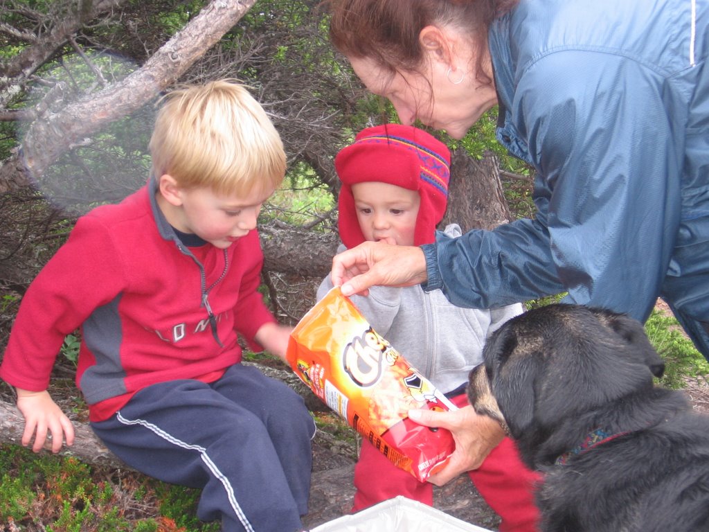
Annie sent the following note to her backpacking buddies. I am going to make a few editorial comments as she goes along. Here is Annie’s report.

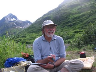
Annie: Last Friday Tim, Elmo and I set out on a 26 mile hike from Crow Pass to Eagle River to be completed by Sunday. The first day was just the most perfect hike I have ever taken and I could not stop thinking of you all and trying to figure out how I could get all of you here.

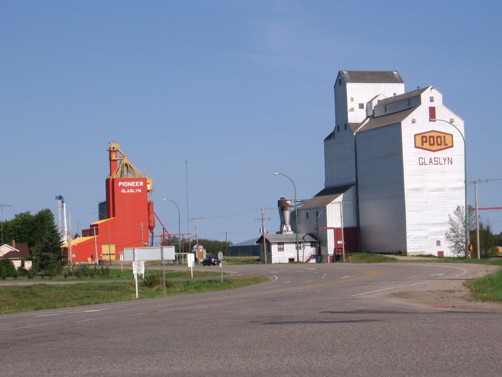
Editors Note: Crow Pass trail was originally the Iditarod Trail. It was developed by a couple of college football defensive line coaches in the late 1800’s to provide a quick way for the prospectors to get from Turnagain Arm to Kinik Arm. After a short period of time it was abandoned in favor of the less dangerous Trail From Hell over Bird Pass. Crow pass trail disappeared. Then in the 1970’s the Girl Scouts (I am not kidding) reestablished the Crow Pass trail. How difficult could a trail be that the Girl Scouts built? Hey wait a minute…(ab)We can handle that.

Annie:

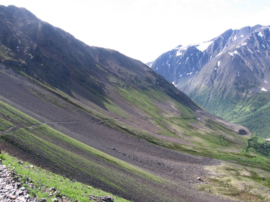
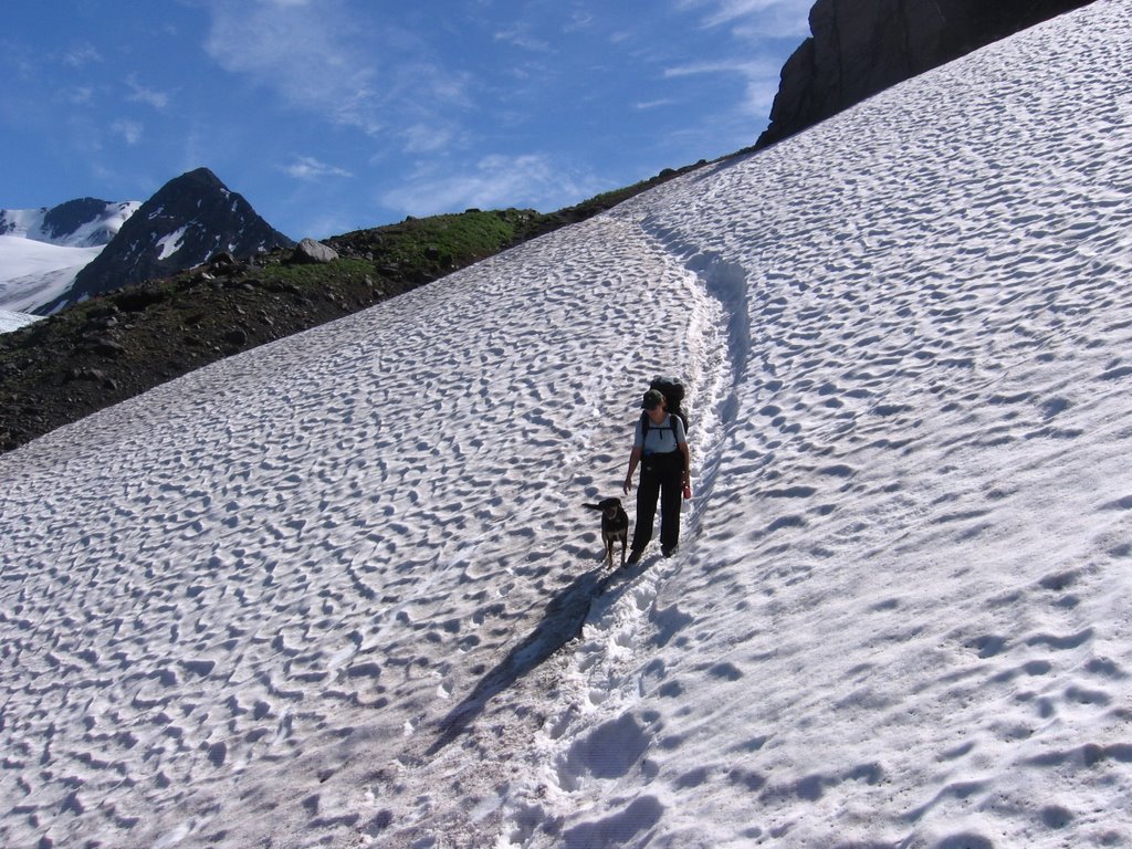
In AK one reaches timber line at about 2200 ft. We started at 2000 ft. so quickly we were hiking above the trees in this glorious area of huge mountains. We went up 2000 ft in 3.5 miles but since the altitude is so low it does not suck the wind from your lungs. At 4000 ft. we looked across at Raven Glacier with its icy blue tones surrounded by a vast landscape of tundra and flowers. After crossing one snow field with Elmo on a leash I quickly decided that the leash law was for someone else. Elmo loved the snow and the remainder of the trail sans leash. There were so many wonderful places to "smirf" ski that I felt like I should have at least tried, but sadly, I did not.

Editor’s Note: Today the trail runs from Girdwood, Anchorage’s downhill ski area, to the Eagle River Nature Center. Every July the Alaskans have a race over the Crow Pass Trail. The winner finishes in around three hours. We were going to take Three days. How difficult could that be? Annie didn’t mention that the snow fields we crossed would have been a little easier to cross with crampons and ice ax.

Annie:

We continued on to a camp site at about mile 6 and stopped for the night a little tired and not knowing just how tired one could be.

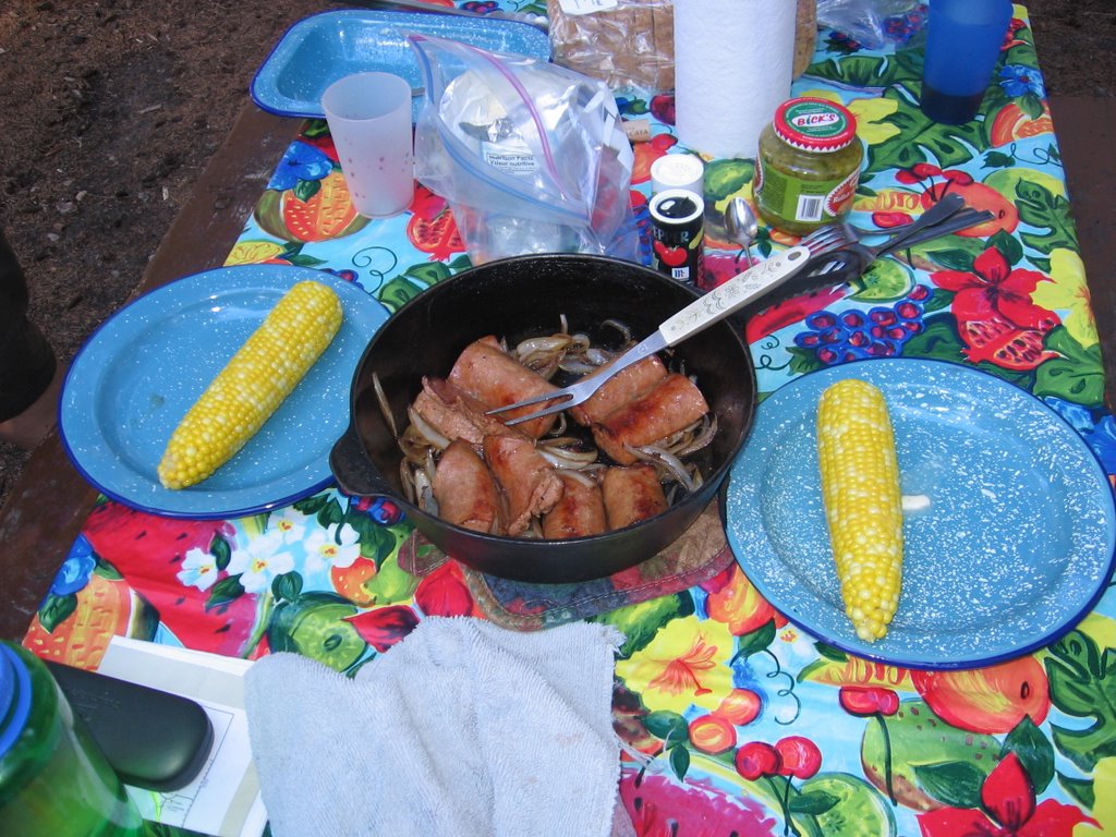
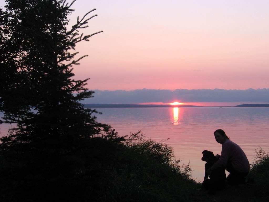
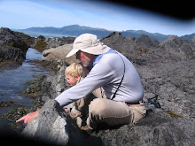
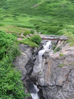
Editor’s Note: We had to ford Clear Creek, which dumped into Raven Creek and which is nothing like the Clear Creek at the end of Hartlee Field Road. This was Elmo’s first chance to cross a roaring glacial stream. He didn’t want to go, but as soon as Annie was on the other bank, there was no holding him back. High on the mountain across Raven Creek, Surprise Creek tumbled in a quadruple fall down a cliff. We found our campsite just on the other side of the footbridge that crosses Raven Gorge. We sipped Scotch and had a dinner of smoked salmon and couscous and watched the light move slowly up the mountain. Four sheep climbed to a ledge near the top of the mountain across Raven Creek and bedded down for the night. The creek roaring down the gorge lulled us to sleep. Life is good.

Annie:

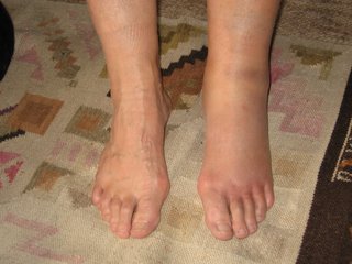
The next day at about mile 9 (17 miles left to walk), while looking at flowers, I turned my ankle and fell flat. All I could do was cry, but Elmo kissed my tears away. Since I didn't really have a big choice, I took a bunch of ibuprofen, unloaded some weight to Tim, and moved on very slowly.

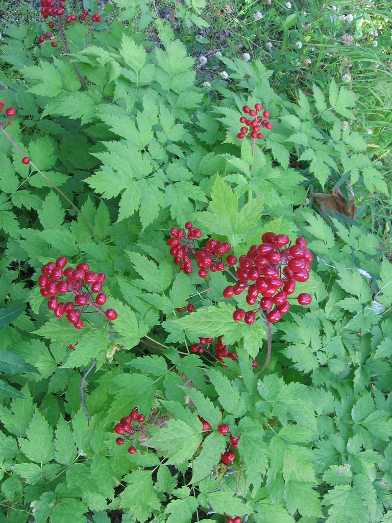
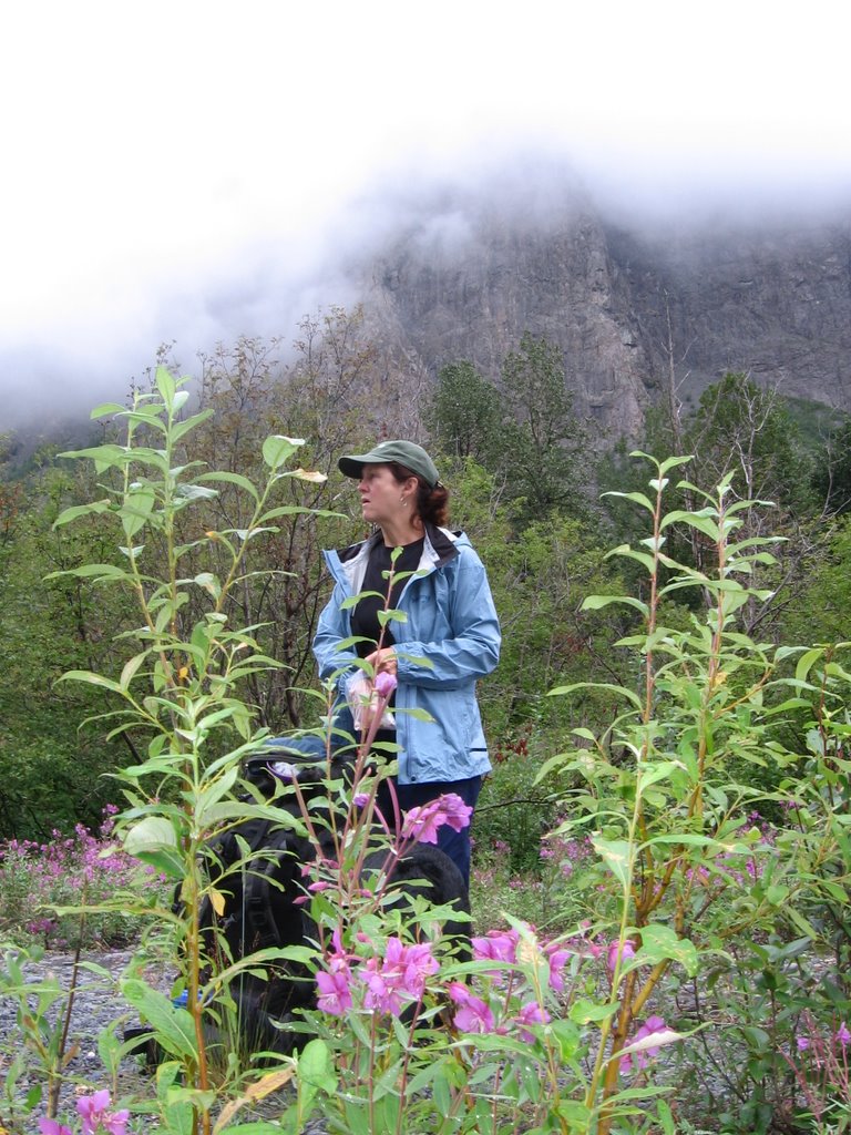
Editor’s Note: She crushed her ankle. Look at the pictures. If it had been me I would still be lying up there on the mountain crying. Annie is a tough lady. But why worry? The Girl Scouts built this trail, and a few days earlier a couple hundred idiots ran the whole trail in hours. We can make it. The flowers Annie was looking at when her ankle went out were spectacular. The trail was a twelve inch rocky dirt groove between two five foot walls of grass, cow parsnip, goat’s beard, yellow fleabane, and larkspur. Sometimes the trail passed over a rocky place (like where Annie fell) covered in the shorter flowers; dwarf fireweed, yellow paintbrush, death camas, moss champion, wild geranium, pink asters, spring beauty, marsh marigolds, and many more. It is easy to understand Annie’s distraction.

Why didn’t we go back; only nine miles that way? Good question. We felt the trail was too difficult that direction and that it would be easier to walk down hill on an easy trail more miles than go back up a difficult trail. How little we knew.

Annie:

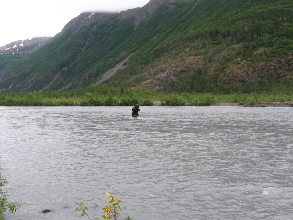
At about mile 14 we came to the glacier melt river that had to be crossed by wadding. This actually felt great to the ole foot since by the time I reached the other side my legs and feet were completely numb

.

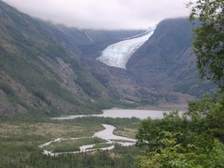
Editor’s Note: Eagle River flows from a glacial lake formed by the massive Eagle Glacier. The Glacier and the lake were just above the ford. The temperature of the water is just a little warmer than the glacier ice, and the river at the ford is a little over 100 yards wide. It rushes over a rocky bed that you cannot see because of the milky color of the glacial river, and it is thigh deep most of the way. This was Elmo’s first glacial river crossing and I tried to help him. He should have been helping me. He is unbelievably powerful. I ended up using most of my energy trying to keep him from turning back to be with Annie.

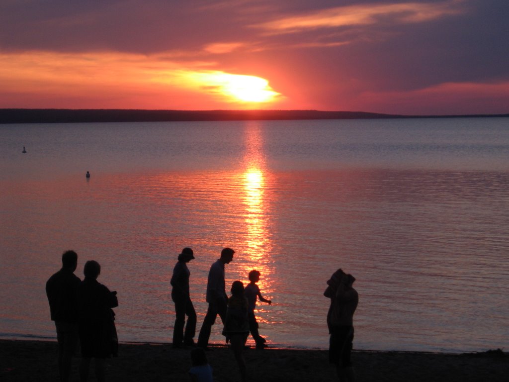
Annie had some difficulty when she first started but quickly found a technique that adjusted for her ankle. While we were resting at the ford with about 13 miles left to walk, a group of day hikers/runners came through. They were out for a Saturday walk and many of them had their dogs with them. These folks were not youth; maybe not quite as old as me, but close. The trail now led along the bank of the Eagle River, gently down hill to the Nature Center. The day hikers were laughing and playing as they took off down the trail.

Annie:

OK so now we had completed the big challenge and were on to the remainder of the trip. Within about two miles we came to another creek crossing which was by log with a rope tied to trees above for holding. This was easy for humans but Elmo didn't exactly like the raging water below. Tim tried to pick him up but he really panicked then. We ended up with me on the other side at waters edge and Tim with Elmo at the beginning edge. With a little encouragement from me, Elmo swam across. OK should be a piece of cake from now on. We started climbing and climbing and came to an area that looked like a giant dirt slide with a rope to hang to while going down. Going down was the biggest challenge for the foot. After getting to the bottom we then got to a wooden ladder which we had to negotiate up a rock cliff. Elmo has not climbed many ladders in his day so Tim ends up picking him up and hoisting him up far enough that he can get to the rock. Now I am even wondering about writing about all this cause it is starting to not even sound real but I really could not make this up. Oh yes, and there was the rock ledge with a rope attached to the top that we had to use to pull ourselves up. Rapelling has not been in my list of adventures to complete. Any way we hiked on until 6 PM and decided that we really could not go on any further for the night. We quickly got out the Scotch and thought seriously about just going to bed but we actually cooked and ate. At this moment I decided that this might not be such a great trip for our group after all.

Editor’s Note: Our map showed the trail following the relatively flat area near the river. However the map had a contour interval of 100 feet. That means that ridge lines and cliffs 99 feet high would not show on the map. The terrain the trail covered from Thunder Gorge where Elmo swam the thundering creek to Twin Falls where we camped the second night was a series of ridges coming down the mountains to the river, one ridge after the other. We climbed one ridge, slipped and stumbled down the other side and then did the same on the next ridge and the next and then the next and then the next. They wouldn’t stop coming. It was like a boxer that jabs constantly and gets stronger round after round. The first two hundred jabs are blocked or don’t hurt. Then you miss one or two. Then they begin to hurt, and you wonder if they will ever stop.

The vegetation was alders, white spruce, cottonwoods, head high grass, cow parsnip, devil’s club and hundreds of other species. Each species fought for space to grow and space to reproduce, and the only space left was the trail. At times you felt that if you stopped the plants would grow right over you. The trail is maintained primarily by feet. Feet never get rid of rocks or roots. When the trail begins to slide toward the river, feet help the slide. The slide stops when the feet hit another rock or root. Hiking this part of the trail is much like a four mile long obstacle course; roots like jungle jims, rocks like climbing walls and super slides, dirt like pound cake left in the sun for several days or like chocolate pudding. Then throw in skinny logs over creeks and mud bogs, ladders up cliffs, repelling ropes down dirt banks and up slick rocks. And when the trail is flat and straight, cover it with roots, slick like popsicles, and rocks with sharp edges ready to turn the already weak ankle. Every step must be carefully placed. Concentration on each step becomes more difficult as one becomes more fatigued. Sooner or later a mistake made. We stopped in time.

Annie:

It rained all night but stopped by the time we got up the next day - a nice thing to happen. The trail, however, was a trail through alders and cow parsnip that were about 6 feet tall and totally wet. We just thought can there be any more challenging things and then the bear poop started showing up every few feet. Tim was singing and I was praying. We actually made pretty good time despite the fact that I was hobbling along up and down the cliffs and arrived at the trail end about 3:30 PM. In retrospect, it was a fabulous trip and will provide years of tales.

Editor’s Note: We have been back in “civilization” for three days. Annie’s doctor (Joey) has required her to stay off her feet for a week. That is like telling a frog not to croak. The blue part of her foot is now spreading up her leg. I think we may have to amputate. I am more and more impressed that she finished that trail and that she did so with such a wonderful attitude. We both feel that this trail was a special experience, and that we are happy to have had the chance. There are not many places as beautiful and as demanding. I have tried to think of an analogy that would help explain our feeling about this experience. This is the best I can do so far: Hiking the Crow Pass Trail is like having a girlfriend who is a Miss Universe and a masochist. She was great to look at, but the relationship was painful. We are glad we did it and glad it is over. Thanks to the Girl Scouts.